Posted on the 16th of May 2026
Winterton Dunes - Lichen
Winterton dunes
Experimental Design
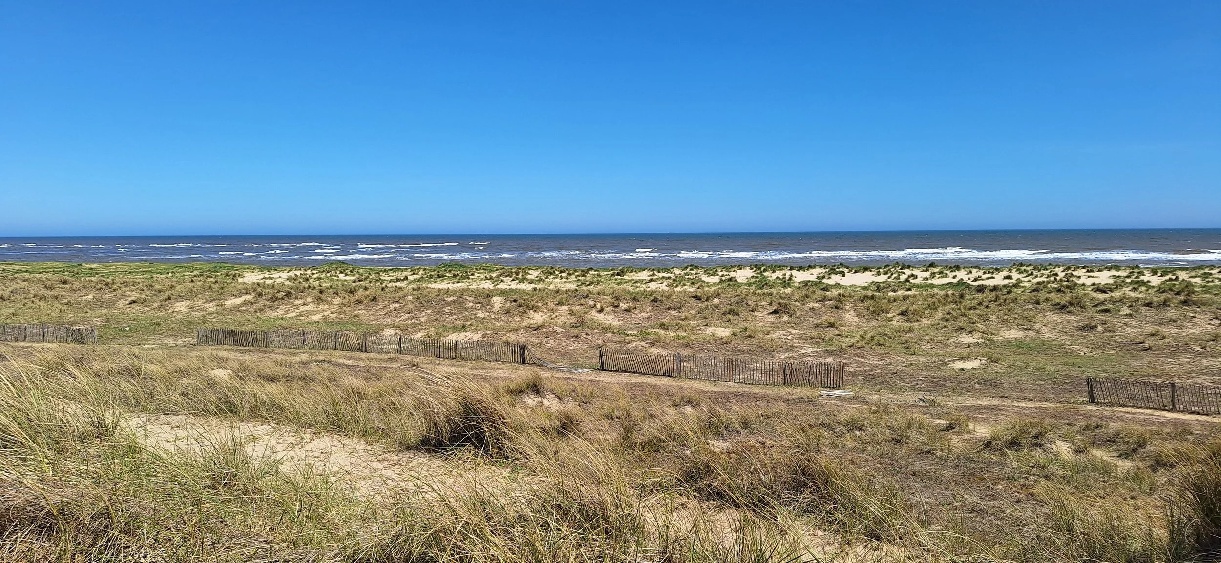
Winterton dunes is a very large and complex dune system located on the east coast of Norfolk, between the villages of Winterton-on-Sea and Horsey. Winterton dunes has an extensive grey dunes covered in lichen. An important habitat that is fairly rare in England and as such has a lot of protections. The site is a national nature reserve and a site of special scientific interest. People love to walk along these dunes, especially with dogs. As people walk along these dunes, the ground below them is trampled, creating a system of paths. It looks like this trampling is causing the lichen to dissapear but looks can be decieving so we ran an experiment to collect evidence to prove or disprove this theory.
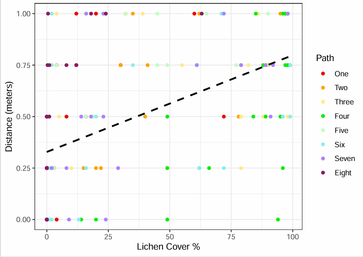
We ran four transects per path for eight paths using a 0.25m² quadrat. We determined the center of each path as the area that was the most visibly trampled and barren. Placing our first quadrat in the center, we’d then move our quadrat out to the side, away from the path. This meant that each transect would record data from 0, 0.25, 0.5, 0.75 and 1 meter(s) away from the path’s center. Once we’d completed a transect, we would walk three meters down the path and do our next transect until we had completed four transects for that path, at which point we’d move on to a new path.
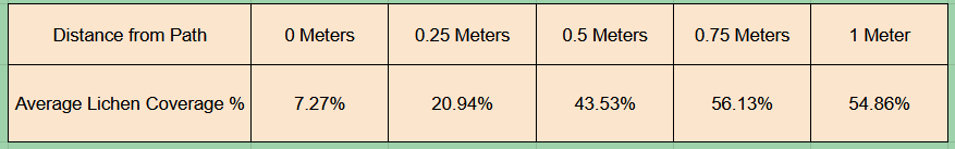
For each quadrat, we recorded species richness, lichen cover % and total plant and lichen cover %. The latter two can be used to calculate total plant cover for each quadrat by taking away lichen cover % from total plant and lichen cover %. Our data supports the initial hypothesis of the paths causing a decrease in the amount of lichen on the dunes. To the right (below if on mobile or tablet) is a scatter graph of our data with a line of best fit, which shows that lichen cover % increases with distance from the center of the path. Also on the right is a table with the average lichen cover % for each distance; this also shows that lichen coverage increases with distance from the path center. The average lichen coverage decreases at 1 meter, as when some paths are particularly close to one another, the transect would go into that path, most commonly occurring at 1 meter.
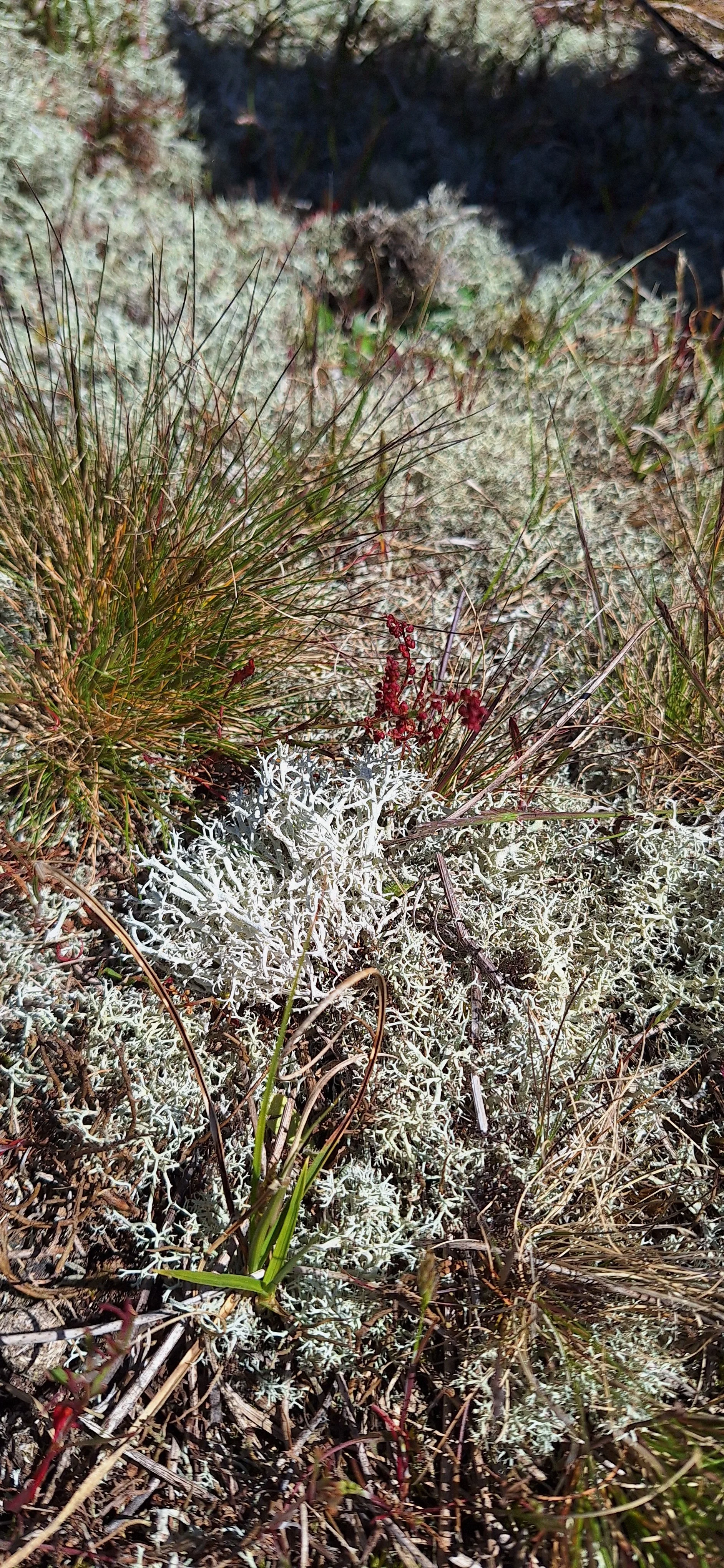
Some of the lichen at Winterton dunes
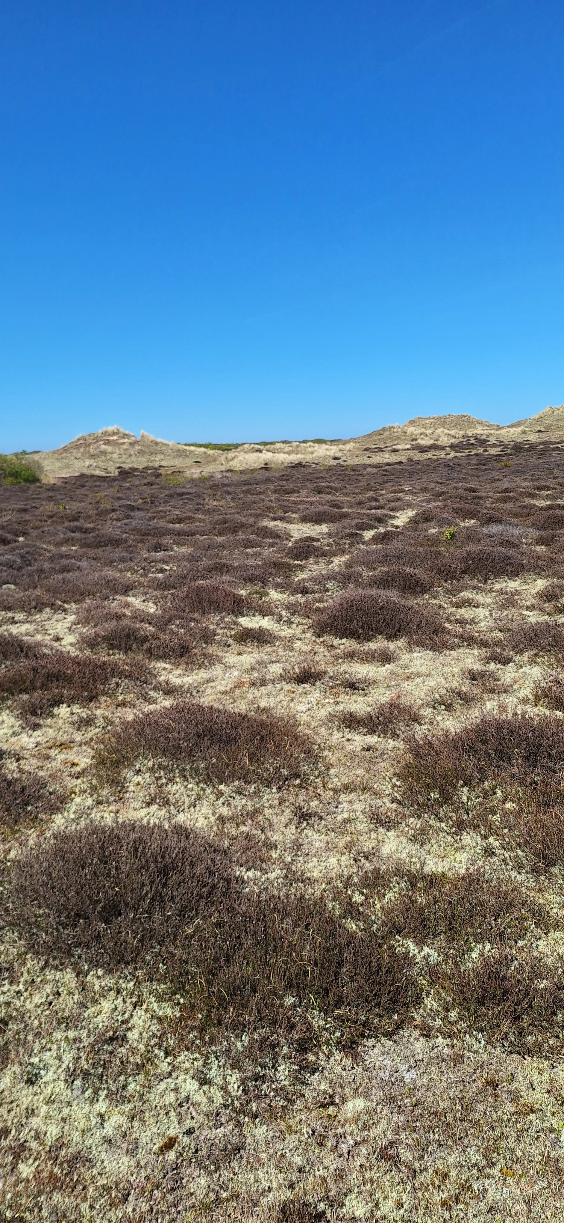
Heather and lichen covering an area of Winterton dunes
Issues and Solutions
The data clearly shows that paths are a problem, reducing the amount of lichen at Winterton dunes. If I were in charge of managing the site, I’d make a few changes to increase the lichen abundance. I’d start by banning bikes from the site, as the weight and speed of a person on a bicycle can cause a lot of damage to the lichen. I would also close the site at certain times of the year, probably between March and August, this would allow the site to rest and regenerate without being trampled over the prime growing seasons of spring and summer. People also tend to go on fewer walks during cold and dreary wether so when the site is open in Spetember-February few people would be walking and trampolin the lichen. The last change I’d make would be creating more fenced off areas to ensure there are always areas of untrampled lichen.
Given more time, the experiment could have been improved. We initially intended to sample ten paths instead of eight, but we couldn’t due to time restrictions. Given more time we could have doubled the number of transects per path to eight, and we could have increased the number of sampled paths up to thirty. That would have given us data from 240 transects, which is 208 more transects than what we had time for. This would have made our data far more accurate.
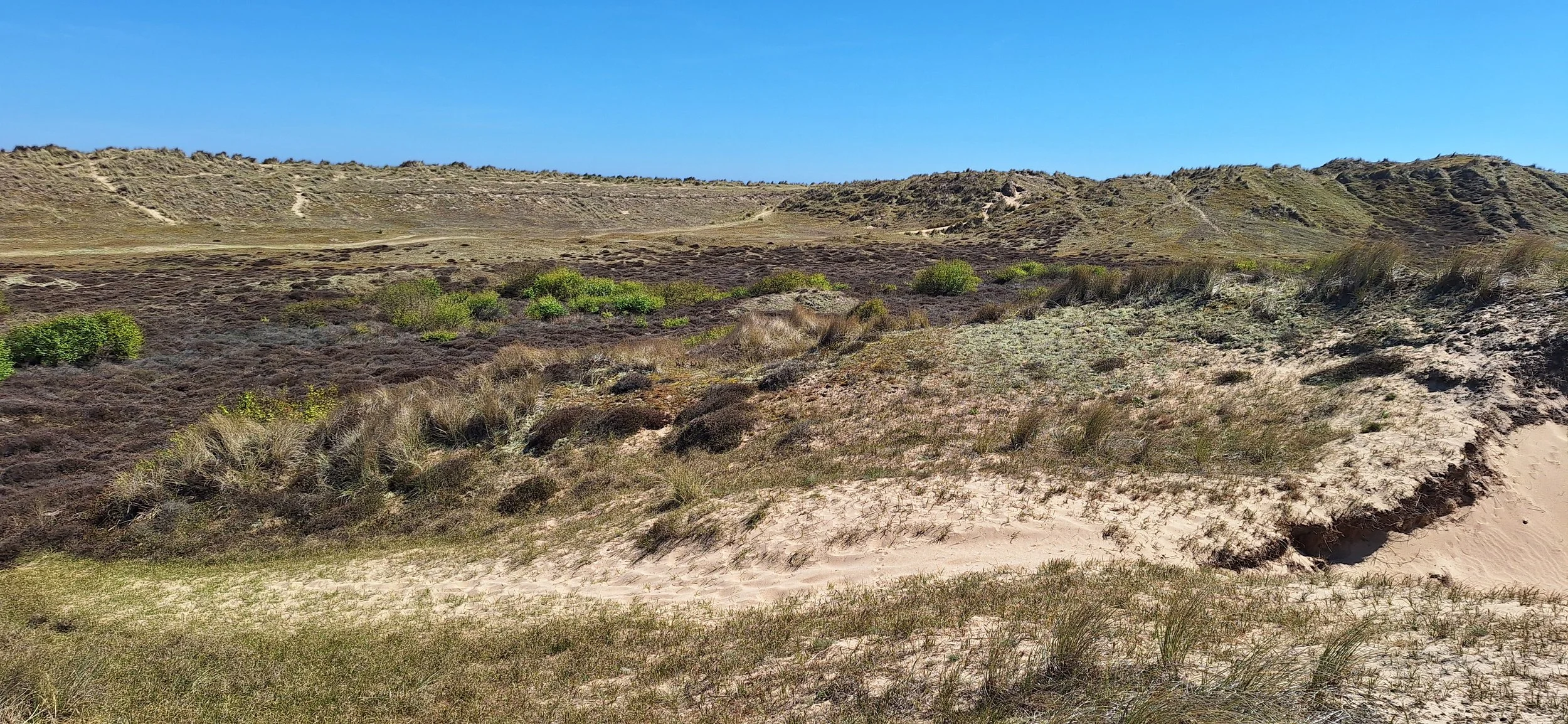
An example of how barren the paths are compared to the rest of the dunes